Remote Sensing – fundamentals and applications
Remote Sensing – fundamentals and applications, available at $19.99, has an average rating of 4.35, with 18 lectures, based on 32 reviews, and has 2556 subscribers.
You will learn about Remote Sensing Background Types of Remote Sensing Applications of Remote Sensing data Multispectral Satellite data Microwave (Radar) Satellite data Hyperspectral, Satellite data Applications in Land Cover Applications in Agriculture Applications in Forestry, Applications in Geology, Applications in Hydrology, Applications in Sea-ice, Applications in Oceans and Coastal This course is ideal for individuals who are geographers or geology proffesionals or GIS users or land science proffesionals or earth science students and teachers or social studies teachers It is particularly useful for geographers or geology proffesionals or GIS users or land science proffesionals or earth science students and teachers or social studies teachers.
Enroll now: Remote Sensing – fundamentals and applications
Summary
Title: Remote Sensing – fundamentals and applications
Price: $19.99
Average Rating: 4.35
Number of Lectures: 18
Number of Published Lectures: 18
Number of Curriculum Items: 18
Number of Published Curriculum Objects: 18
Original Price: $94.99
Quality Status: approved
Status: Live
What You Will Learn
- Remote Sensing Background
- Types of Remote Sensing
- Applications of Remote Sensing data
- Multispectral Satellite data Microwave (Radar) Satellite data Hyperspectral, Satellite data Applications in Land Cover Applications in Agriculture
- Applications in Forestry, Applications in Geology, Applications in Hydrology, Applications in Sea-ice, Applications in Oceans and Coastal
Who Should Attend
- geographers
- geology proffesionals
- GIS users
- land science proffesionals
- earth science students and teachers
- social studies teachers
Target Audiences
- geographers
- geology proffesionals
- GIS users
- land science proffesionals
- earth science students and teachers
- social studies teachers
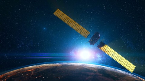
Remote sensing is the process of detecting and monitoring the physical characteristics of an area by measuring its reflected and emitted radiation at a distance (typically from satellite or aircraft). Special cameras collect remotely sensed images, which help researchers “sense” things about the Earth. Some examples are:
-
Cameras on satellites and airplanes take images of large areas on the Earth’s surface, allowing us to see much more than we can see when standing on the ground.
-
Sonar systems on ships can be used to create images of the ocean floor without needing to travel to the bottom of the ocean.
-
Cameras on satellites can be used to make images of temperature changes in the oceans.
Some specific uses of remotely sensed images of the Earth include:
-
Large forest fires can be mapped from space, allowing rangers to see a much larger area than from the ground.
-
Tracking clouds to help predict the weather or watching erupting volcanoes, and help watching for dust storms.
-
Tracking the growth of a city and changes in farmland or forests over several years or decades.
-
Discovery and mapping of the rugged topography of the ocean floor (e.g., huge mountain ranges, deep canyons, and the “magnetic striping” on the ocean floor).
Section-1: Introduction
-
Course Introduction
Section-2: Remote Sensing Background
-
Remote Sensing
-
Principle of Remote Sensing
-
Important concepts for Principle of Remote Sensing
-
History of Remote sensing
Section-3: Types of Remote Sensing
-
Sensor based types of Remote Sensing
-
Resolution based types and characteristics of Remote Sensing
-
Purpose based types of Remote Sensing
Section-4: Applications of Remote Sensing data
-
Multispectral Satellite data
-
Microwave (Radar) Satellite da ta
-
Hyperspectral Satellite data
-
Applications in Land Cover
-
Applications in Agriculture
-
Applications in Forestry
-
Applications in Geology
-
Applications in Hydrology
-
Applications in Sea-ice
-
Applications in Oceans and Coastal
Course Curriculum
Chapter 1: Introduction
Lecture 1: Course Introduction
Chapter 2: Remote Sensing Background
Lecture 1: Remote Sensing
Lecture 2: Principle of Remote Sensing
Lecture 3: Important concepts for Principle of Remote Sensing
Lecture 4: History of Remote sensing
Chapter 3: Types of Remote Sensing
Lecture 1: Sensor based types of Remote Sensing
Lecture 2: Resolution based types and characteristics of Remote Sensing
Lecture 3: Purpose based types of Remote Sensing
Chapter 4: Applications of Remote Sensing data
Lecture 1: Multispectral Satellite data
Lecture 2: Microwave (Radar) Satellite data
Lecture 3: Hyperspectral Satellite data
Lecture 4: Applications in Land Cover
Lecture 5: Applications in Agriculture
Lecture 6: Applications in Forestry
Lecture 7: Applications in Geology
Lecture 8: Applications in Hydrology
Lecture 9: Applications in Sea-ice
Lecture 10: Applications in Oceans and Coastal
Instructors
-

Mirza Waleed
Geospatial Researcher -
Golgi Alvarez
Land Administration and AEC Specialist


Rating Distribution
- 1 stars: 0 votes
- 2 stars: 0 votes
- 3 stars: 3 votes
- 4 stars: 3 votes
- 5 stars: 26 votes
Frequently Asked Questions
How long do I have access to the course materials?
You can view and review the lecture materials indefinitely, like an on-demand channel.
Can I take my courses with me wherever I go?
Definitely! If you have an internet connection, courses on Udemy are available on any device at any time. If you don’t have an internet connection, some instructors also let their students download course lectures. That’s up to the instructor though, so make sure you get on their good side!

- Top 10 Video Editing Courses to Learn in November 2024
- Top 10 Music Production Courses to Learn in November 2024
- Top 10 Animation Courses to Learn in November 2024
- Top 10 Digital Illustration Courses to Learn in November 2024
- Top 10 Renewable Energy Courses to Learn in November 2024
- Top 10 Sustainable Living Courses to Learn in November 2024
- Top 10 Ethical AI Courses to Learn in November 2024
- Top 10 Cybersecurity Fundamentals Courses to Learn in November 2024
- Top 10 Smart Home Technology Courses to Learn in November 2024
- Top 10 Holistic Health Courses to Learn in November 2024
- Top 10 Nutrition And Diet Planning Courses to Learn in November 2024
- Top 10 Yoga Instruction Courses to Learn in November 2024
- Top 10 Stress Management Courses to Learn in November 2024
- Top 10 Mindfulness Meditation Courses to Learn in November 2024
- Top 10 Life Coaching Courses to Learn in November 2024
- Top 10 Career Development Courses to Learn in November 2024
- Top 10 Relationship Building Courses to Learn in November 2024
- Top 10 Parenting Skills Courses to Learn in November 2024
- Top 10 Home Improvement Courses to Learn in November 2024
- Top 10 Gardening Courses to Learn in November 2024